Ethnicity
According to the 2011 Census, 85.5% of Trafford's residents self-report as White, 7.9% as Asian, 2.9% as Black, 2.7% as Mixed, and 1% as Other. This composition broadly reflects the ethnic diversity of England and Wales in 2011.
Ethnic groups by ward
In Clifford ward, the majority of the usual resident population reported their ethnic group as Asian (35.9%) or White (35.4%). Longford ward is also relatively diverse with 40.6% of residents reporting as belonging to a Black, Asian, and minority ethnic (BAME) group.
However, several wards are ethnically homogeneous with the majority of residents belonging to a single dominant ethnic group. For example, 96.2% of the residents of Flixton ward self-reported as White in 2011.
Spatial distribution and density
Figure 2 is a multivariate dot density map which shows the spatial distribution and density of self-reported ethnic groups in Trafford according to the 2011 Census. Each dot represents 10 residents and is colour coded by broad ethnic group. Individual dots are randomly scattered within a particular Census Output Area to match the total population for that area. Some points may therefore be located on areas of non-population like parks and industrial estates.
The map shows that wards like Clifford and Longford with lots of different coloured dots are more ethnically diverse than other parts of Trafford.
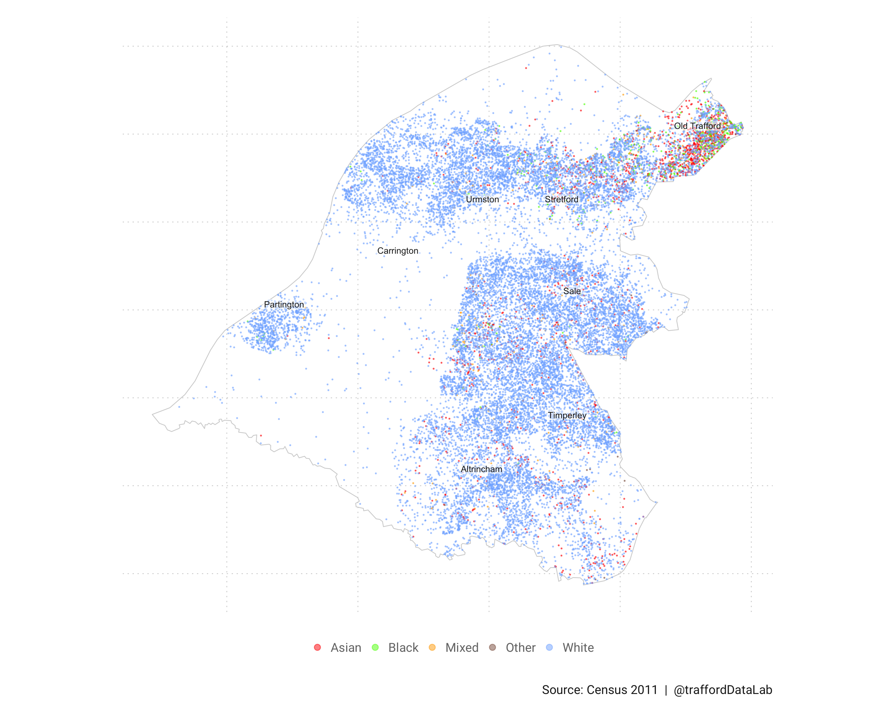
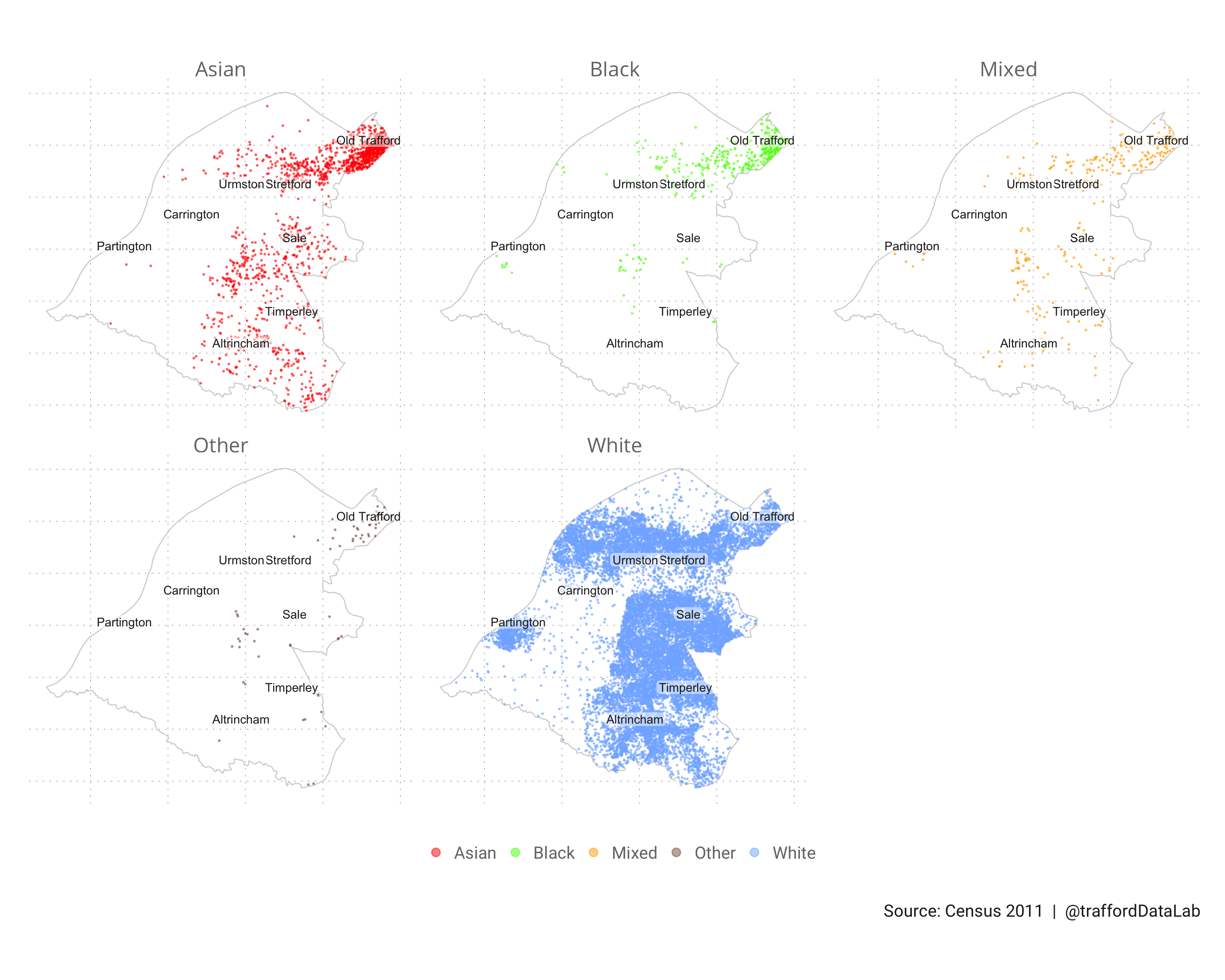
Figure 3 facets the dot density map to reveal the spatial distribution and density of residents by self-reported ethnic group.
Notes
Paul Campbell's blog post was a very helpful guide to the creation of dot density maps in R.
References
Cable, D. (2013). The Racial Dot Map. Retrieved from https://demographics.coopercenter.org/racial-dot-map/
Cheshire, J. & Uberti. O. (2014). London: The Information Capital. London: Particular Books, p. 100-101
Rankin, B. (2009). Chicago Boundaries. Retrieved from http://www.radicalcartography.net/index.html?chicagodots
Data sources
- Ethnic group: Table KS201EW, Census 2011