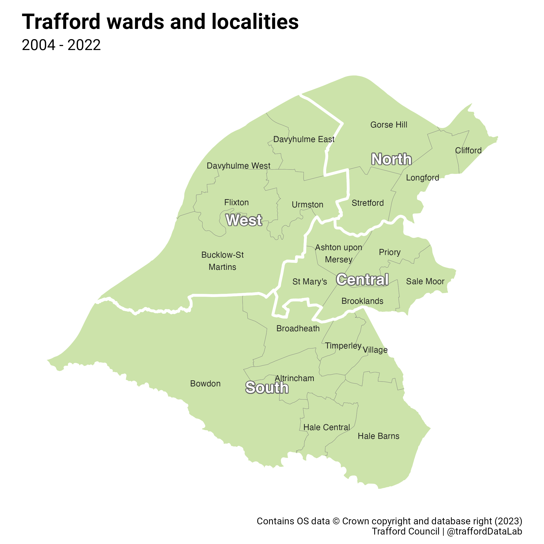
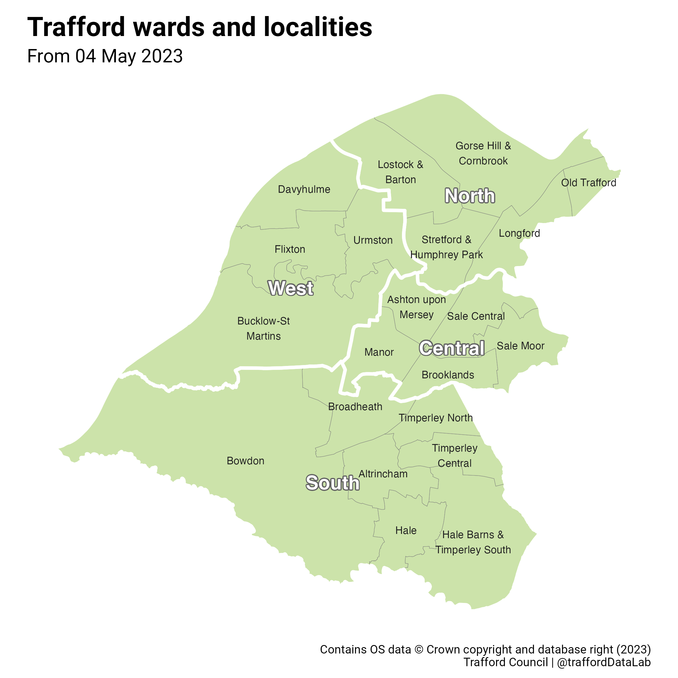
Trafford's changing wards
Electoral wards are administrative areas, represented at council by locally elected councillors to serve the needs of the residents. To ensure fair representation, occasionally these areas are amended, for example if the numbers of electors have become unequal among wards as a result of population changes. For the first time since 2004 Trafford's wards will be changing, with the new boundaries coming into force on 04 May 2023, coinciding with the Local Government Elections in England. There will still be 21 wards, however some of the names and areas they cover will change.
To assist with the management of work that goes on across the borough, Trafford has historically grouped its wards into 4 larger areas known as localities, named "Central", "North", "South" and "West". As the ward boundaries are changing, so too are the localities. The map images show the old ward and locality boundaries compared with the new.
NOTE: Use the slider above, or the following links, to compare the old and new boundaries.
Old wards and localities (2004 - 2022)
- Central: Ashton upon Mersey, Brooklands, Priory, Sale Moor, St Mary's
- North: Clifford, Gorse Hill, Longford, Stretford
- South: Altrincham, Bowdon, Broadheath, Hale Barns, Hale Central, Timperley, Village
- West: Bucklow-St Martins, Davyhulme East, Davyhulme West, Flixton, Urmston
New wards and localities (from 04 May 2023)
- Central: Ashton upon Mersey, Brooklands, Manor, Sale Central, Sale Moor
- North: Gorse Hill & Cornbrook, Longford, Lostock & Barton, Old Trafford, Stretford & Humphrey Park
- South: Altrincham, Bowdon, Broadheath, Hale, Hale Barns & Timperley South, Timperley Central, Timperley North
- West: Bucklow-St Martins, Davyhulme, Flixton, Urmston
You can download the maps as PNG images using the following "OLD" and "NEW" download options respectively, as well as the "R" script that created them.